About Orienteering
Navigation! |
Terrain running! |
Checkpoints! |
|---|---|---|
 Orienteering involves
navigating between checkpoints using a detailed map and compass. Orienteering involves
navigating between checkpoints using a detailed map and compass. |
 Pick your own route
between the checkpoints: Along a path, over a hill, or straight through the
forest! Pick your own route
between the checkpoints: Along a path, over a hill, or straight through the
forest! |
 Checkpoints are
marked with red and white flags, and are indicated by a circle on the map. Checkpoints are
marked with red and white flags, and are indicated by a circle on the map. |
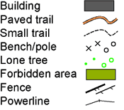
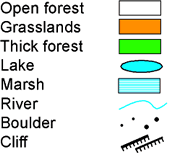
Map Sample |
Legend |
|
|---|---|---|
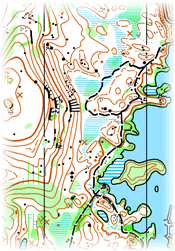
Orienteering uses a very detailed map, typically at a 1:4000 to 1:15 000 scale. Below is a sample map of a
forested area:
|
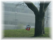
 A checkpoint next to a lone tree:
|
 A checkpoint at the bottom of a small cliff: 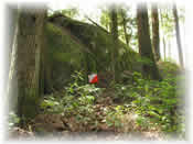
|
The start |
Checkpoints/finish |
Course types |
|---|---|---|
|
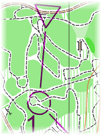
The orienteering course is designed to challenge the participant both in terms of navigation as well as route planning.
You must visit all checkpoints but the route between each is up to you! The start of the course is indicated by a purple triangle on the map: 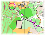
|
Competitors go to each numbered checkpoint in order:
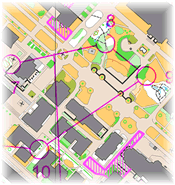
The two concentric circles mark the end of the orienteering course: 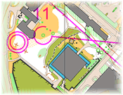
|
short courses around 2-3km with winning times around 12-15 minutes. The course requires the participant to make quick decisions.
25-35 minute winning time. Navigation skills are especially important. 60-90 minute winning time. Route planning skills are essential here. courses run at nighttime where participants use headlamps. participants can visit the checkpoints in any order. |
Try Orienteering Today!
- World
- Canada
- Whitehorse, YK
- British Columbia
- Vancouver, BC
- Southern Interior, BC
- Victoria, BC
- Williams Lake, BC
- Kimberley, BC
- Whistler, BC
- Vancouver, BC
- Comox Valley, BC
- Alberta
- Manitoba
- Ontario
- Quebec
- New Brunswick
- Nova Scotia
- Amherst, NS
- Wentworth, NS
- Annapolis Valley, NS
- Truro, NS
- Dartmouth, NS
- Halifax, NS
- Nova Scotia
- Halifax, NS
- Nova Scotia
- South Shore, NS
- Canada
- Prince Edward Island
- Saskatchewan
- USA
- Bellevue, WA
- Seattle, WA
- Spokane, WA
- Southern Michigan
- Rochester, NY
- Arkansas, Louisiana, Texas
- Austin, TX
- Anchorage, AK
- San Francisco, CA
- Buffalo, NY
- Madison, WI
- Raleigh, NC
- Blacksburg, VA
- Chicago, IL
- Marathon, NY
- Huntersville, NC
- Ashville, OH
- Albany, NY
- Portland, OR
- Cambridge, MA
- Garden City, ID
- Chesterfield, VA
- Delaware Valley
- Clifton Park, NY
- Florida
- Georgia
- Lincoln, CA
- Williston, VT
- Phoenix, AZ
- Houston, TX
- Hudson Valley, NY
- Zionsville, IN
- Peoria, IL
- Los Angeles, CA
- Long Island, NY
- Laramie, WY
- Minneapolis, MN
- Dayton, OH
- Boston, MA
- Cleveland, OH
- Albuquerque, NM
- Dallas, TX
- Cincinnati, OH
- Kansas
- Louisville, KY
- Utah
- Lenexa, KS
- Baltimore, MD
- Denver, CO
- San Diego, CA
- St Louis, MO
- Lake Tahoe, CA
- Tucson, AZ
- New Hampshire
- West Point, NY
- Trussville, AL
- Western Connecticut
- Johnstown, PA